Log in
💲 Seen a product cheaper? We price match 💲 Get in Touch
🎁 Free shipping on orders over $200 🎁
💲💲💲 Finance available to ABN holders Learn more
🦘Australian owned and operated🦘
💲 Seen a product cheaper? We price match 💲 Get in Touch
GET IN TOUCH TO PREORDER
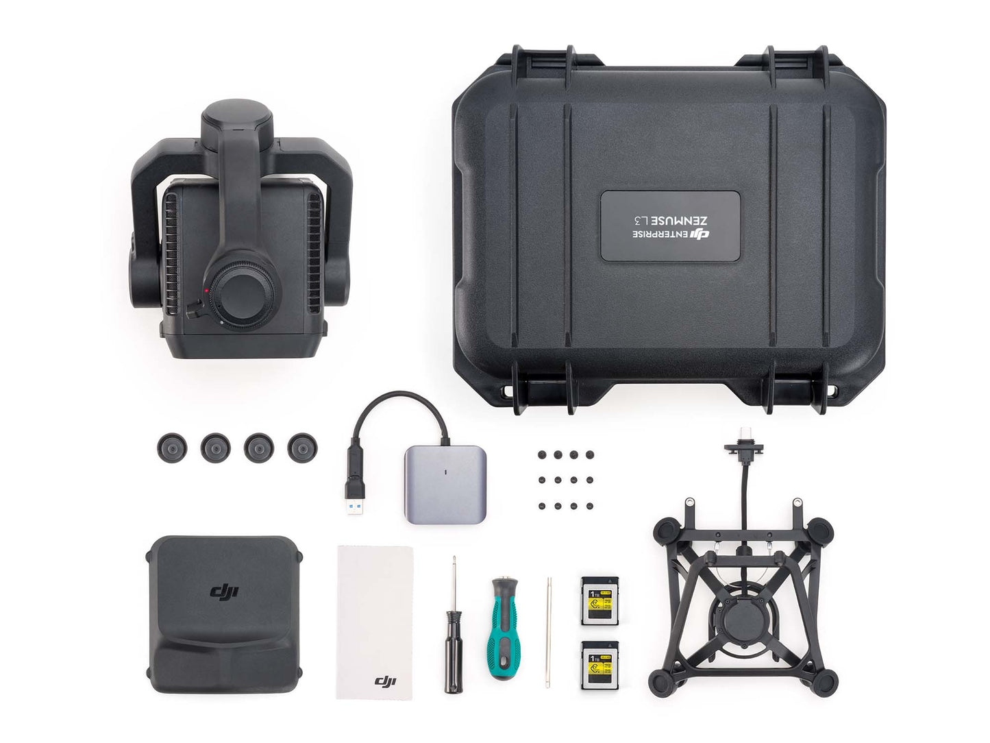
The DJI Zenmuse L3 is a high-precision aerial LiDAR-and-camera system designed for large-scale mapping, infrastructure inspection and forestry work. It features a long-range 1535 nm LiDAR sensor capable of reaching up to 950 m on low-reflectivity targets, enabling efficient coverage of vast areas in a single flight.
Paired with dual 100 MP RGB mapping cameras and a built-in high-accuracy IMU + POS system, operators get both richly detailed imagery and dense point‐clouds in one mission.
Its ability to support multiple laser returns and penetrate vegetation or complex terrain means easier capture of underlying surfaces and hidden features. Integration with DJI’s survey platforms and software streamlines the end-to-end workflow, from data capture through to mapping deliverables, reducing mission time and boosting productivity.
At 120m Flight Altitude:
At 300m Flight Altitude:
Measured in Linear scanning mode, using check points on 80% reflectivity objects, with neither point cloud optimization nor downsampling enabled in DJI Terra. For 6σ, multiply the listed thickness by 6.
107°
Composed by merging images from two cameras with a 45° optical axis angle between them.
DJI Matrice 400 (requires the Zenmuse L3 single gimbal connector)
IP54
-20° to 50° C (-4° to 122° F)
-40° to 70° C (-40° to 158° F)
1535 nm
0.25 mrad (1/e²)
1. Range Definition: The range is defined as the distance at which 50% of the emitted laser pulses are detected. If a laser beam hits more than one subject, the total laser transmitter power is split and the achievable range is reduced.
2. Test Conditions: 100 klx ambient light, within the central area of the FOV, using a flat subject with a size larger than the laser beam diameter, a perpendicular angle of incidence, and an atmospheric visibility of 23 km.
3. The maximum detection range is 900 m by default. For a longer range, contact DJI support or an authorized dealer.
21.6mm Steel Core Aluminum Stranded Wire:
18.4mm Black PVC Insulated Wire:
1. Range Definition: The distance at which a fully scanned section of wire in mapping achieves a point density of 4 points per meter.
2. Test Conditions: 100 klx ambient light, 23km atmospheric visibility, LiDAR center FOV perpendicular to the wire, Non-Repetitive scanning mode, drone flying along the wire at 15 m/s, and the wire is clean and not aged.
The above specifications can be met under test conditions of 25° C (77° F) ambient temperature, 350 kHz pulse rate, 80% object reflectivity, and distances of 120 m and 300 m. The actual environment may differ from the testing environment. The figure listed is for reference only.
10 m
7 times
Class 1 (IEC 60825-1:2014)
4/3 CMOS
JPEG:
RAW or JPEG + RAW:
Resolution:
5 Hz
200 Hz
For field operation, ensure the distance between the Multifunctional Station and the aircraft does not exceed 15 km, and the Multifunctional Station supports satellite observation with more than two GNSS constellations.
3-axis (pitch, roll, yaw)
±0.01°
Structural limit, not controllable range.
Roll is uncontrollable, for stabilization only.
Mounting Method


By clicking the button you agree to the Privacy Policy and Terms and Conditions.


